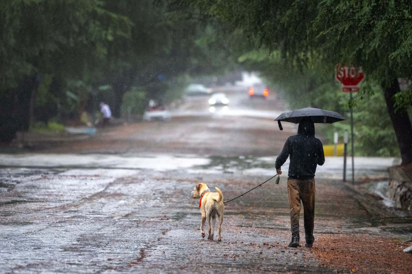
Southern California is bracing for an early winter storm expected into this weekend, prompting evacuation warnings near wildfire burn scars due to flooding and debris-flow risks and extra emergency response crews deployed to the region by the governor.
Small tornadoes and hail could also develop, according to meteorologists.
A flood watch will be in effect from late Friday night to Saturday evening in Orange, Riverside, San Bernardino and Los Angeles counties, the National Weather Service said
Forecasters said excessive runoff could lead to flooding in rivers, creeks, streams and other low-lying or flood-prone areas, and warned that debris-flow risks will be elevated in and around fire burn scars. Flooding may also occur in urban areas with poor drainage.
“With this in mind, residents, especially those in vulnerable areas, should start taking precautions immediately to prepare for the storm and protect their interests,” the NWS announced on Thursday. “This scenario would potentially create many significant impacts area-wide, including possible debris flows in the burn areas, significant ponding of roads and highways, mudslides through the canyons, fallen trees, etc.”
The city of Los Angeles issued an evacuation warning that will be in effect from 6 p.m. Thursday through 11 a.m. Sunday for residents near the Palisades, Hurst and Sunset fire burn zones. County officials, meanwhile, issued an evacuation warning for residents near the Eaton Fire area in Altadena. County officials warned that any other recent burn area could also be at increased risk of flooding or debris flows.
Gov. Gavin Newsom said the state is pre-deploying emergency response crews in Los Angeles, Orange and Ventura counties to enable faster response to any storm-related issues that develop. He said 274 personnel were being deployed, along with 18 engines, three urban search & rescue companies, six bulldozers, three swiftwater-rescue teams, three helicopters and five dispatchers.
Lighter showers are expected through most of Friday in Orange County before rainfall intensifies overnight, NWS meteorologist Philip Gonsalves said. The heaviest rainfall will likely arrive early Saturday morning.
Rainfall rates will vary, but during the peak of the storm Saturday, Orange County may see roughly a quarter-inch to a half-inch per hour. Total rainfall from Friday night through Sunday afternoon may reach up to 3.5 inches, Gonsalves said.
Riverside and San Bernardino counties are expected to trail Orange County by a few hours, with their strongest rainfall mid- to late Saturday morning. The Inland Empire is expected to be partially rain-shadowed by the Santa Ana Mountains, keeping totals just under 3 inches.
“Debris flow is primarily going to be a concern Saturday morning,” Gonsalves said. “Even where there’s no burn scar, there’s still a risk.”
Another system is likely to bring on-and-off showers Monday and Tuesday across Southern California, Gonsalves said, with more information on anticipated rainfall to come this weekend.
Across Los Angeles County, light to occasionally moderate showers are expected Friday afternoon into early Saturday morning, the NWS said. Forecasters estimated 2 to 4 inches of rain by the time the systems move out Sunday, with 3 to 6 inches possible in foothill and mountain areas. Most of that rain is expected Saturday morning when the second storm impulse moves through.
The city of Los Angeles’ Emergency Operations Center will activate at 6 p.m. Thursday, and the mayor’s office stated that it will coordinate with the Emergency Management Department, Los Angeles Fire Department, Los Angeles Police Department, Los Angeles County Public Works and relevant city departments to ensure all personnel are ready to respond as needed to keep residents safe.
The county was offering residents free sandbags for pickup at the Public Works Fleet Maintenance Yard, 252 Mountain View St. in Altadena, and at the Malibu Library parking lot, 23519 W. Civic Center Way.
In the Palisades Fire area, Caltrans will close Topanga Canyon Boulevard between Pacific Coast Highway and Grand View Drive at 10 p.m. Thursday. Caltrans officials said motorists should expect the stretch to remain closed at least through the Friday morning commute, but potentially through the weekend, depending how the storm develops.
That stretch of Topanga Canyon has been undergoing nightly repairs, with the road closed between midnight and 5 a.m.
The Los Angeles County Sheriff’s Department urged residents to prepare by driving carefully and slowing down, avoiding flooded roads, gathering sandbags, checking gutters and drains, and ensuring vehicles are in good condition — including replacing windshield wipers and tires if needed.
Officials also encouraged residents to monitor Ready.LA County.gov Prepare.SB County.gov and Ready OC.com for road closures, weather alerts and emergency notifications.
City News Service contributed to this report.
Biggest fall rainstorm yet heads toward Southern California, landing Thursday