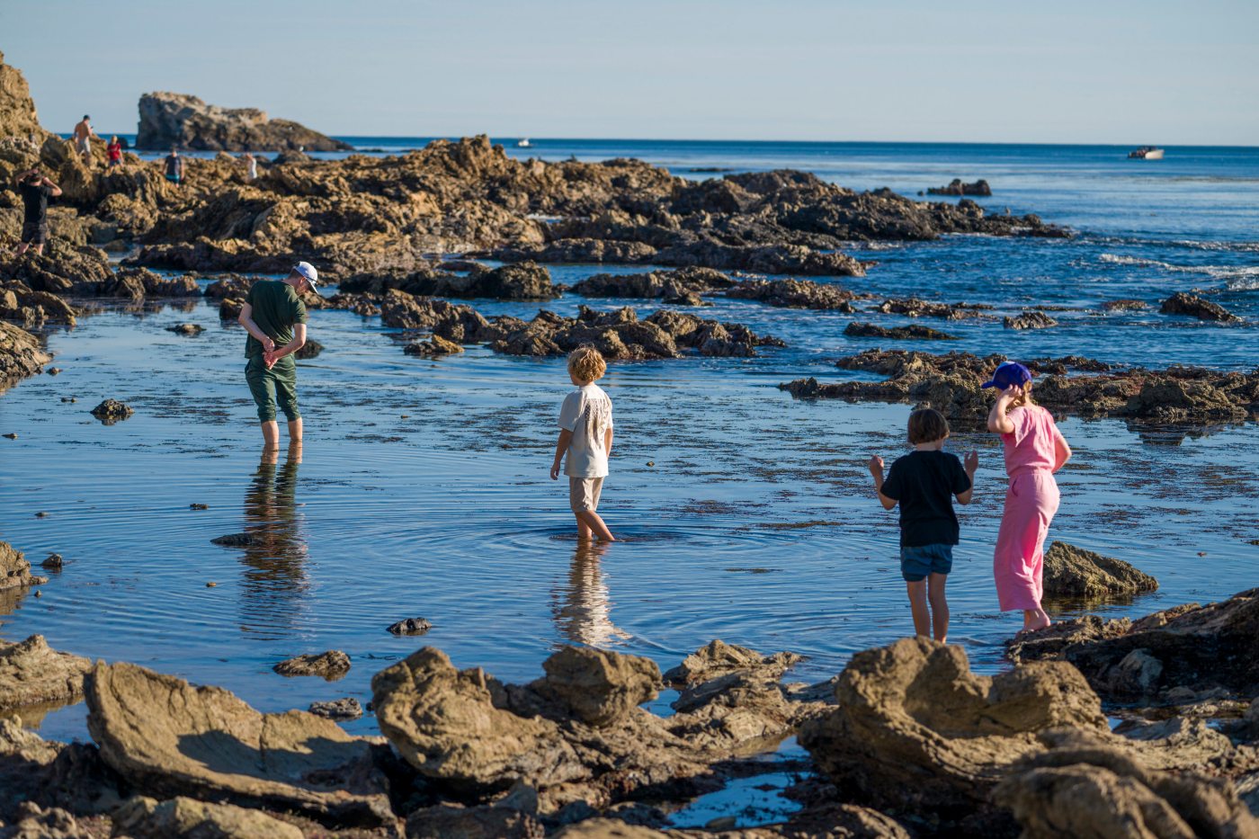
The king tides happening across Southern California later this week are a chance to see the power of the ocean — and sometimes how damaging it can be when high tides reach structures, roads and homes — but also open up an underwater world for several hours during low tide.
King tides are a natural, predictable phenomenon that lets scientists and everyday marine enthusiasts marvel at the changing seascape that is vastly different in just a few hours. And with many friends, family and visitors in town, the tide pools that appear are an inexpensive way to get out and explore nature. Hopefully the rain cooperates.


“The king tides have the highest highs, and the lowest lows of the year,” said Christine Whitcraft, professor of biological sciences at Cal State Long Beach, noting that the highest and lowest tides will occur from Jan. 1 through Jan. 4.
King tides are caused when the sun, moon and Earth are aligned, creating a stronger-than-normal gravitational pull.
The drastic changing of tides — near 7 feet high in early morning hours and negative tides in the afternoon — show “just how cool the ocean is,” she said.
Low tides offer a look as the ocean peels back to give people a glimpse at the critters and plant life usually underwater.
“I love it because suddenly, we can see all the subtidal areas now exposed,” Whitcraft said.
“Suddenly we are seeing the far edges of the tide pools, the oysters beds we have restored and some of the mudflats and eelgrass that are usually hidden,” she said. “I think because we’re not marine creatures, we don’t get access to that very often. This is really the hidden end of the world we’re getting to see on our terms.”
On the other side of the tidal swing, the highest tides of the year can show the “power of the ocean,” Whitcraft said.
From a more scientific perspective, the high tides help visualize what future sea level rise will likely look like, she said.
“When you combine them with any kind of weather — rain or wind or surf surge — it’s pretty dynamic,” she added.
Recent rains mean water levels in harbors are already higher, and there’s a chance of overspill during early-morning hours that could make a mess of Pacific Coast Highway in low-lying areas such as Sunset Beach.
From the ocean side, surf in the 3- to 4-foot range isn’t massive, but the combination of high tides could send ocean water into parking lots or flood streets and homes in areas such as Capistrano Beach and the Newport Peninsula.
Whitcraft’s team is part of the California King Tides Project, an initiative of the California Coastal Commission that asks scientists and the public to photograph the impact of waves and rising groundwater on shorelines and nearby communities during king tides.
Photographing these extreme high tides brings attention to the impact of climate change and helps prepare for the future, organizers with the California King Tides Project said in a statement. “The images are used by climate researchers, as well as local and state officials, to validate sea level rise models and assess local vulnerabilities to erosion and flooding.”
The project is one of many similar citizen science efforts across the world to create a visual record of changing coastlines.
“We’re interested in monitoring sea level rise resilience along the coast,” Whitcraft said. “How do these systems respond to events like king tides and storm surge?”
One area they monitor is San Clemente, where water has been known to overtop railroads tracks. They also document areas that have natural resistance, such as plants and dunes, to see how those systems respond to seawater.
“It’s important to document the conditions for our coast to understand how they will be impacted, but also to design solutions,” Whitcraft said.
At estuaries, such as Batiquitos Lagoon in Carlsbad, Bolsa Chica in Huntington Beach and Colorado Lagoon in Long Beach, they monitor plant life and tidal gauges that have been left out to see how high the water reaches.
The public is advised to prioritize safety when taking king tides photos: Stay clear of waves and always be aware of the ocean. Give space to shore birds or other animals that may be further inland than usual during these extreme high tides.
The tides on Thursday will reach nearly 7 feet at about 6:30 a.m. and be at their lowest around 2 p.m.; on Friday, the high tide, which will now be more than 7 feet, is about 7:30 a.m. and low tide is about 3 p.m.; on Saturday, high tide will be about 8:15 a.m. and low tide around 3:30 p.m.; and on Sunday, high tide will be about 9 a.m., still more than 7 feet, and low tide will be about 4:22 p.m.
Some spots for exploring the tide pools are in Crystal Cove, along Laguna Beach’s rocky shoreline, such as Treasure Island, and the shore in Corona Del Mar.
There are several marine protected areas along the coastline, which prohibit removing animals, shells or rocks from tide pools; and experts encourage looking but not touching to preserve the ecosystems.
Submit your photos to coastal.ca.gov/kingtides