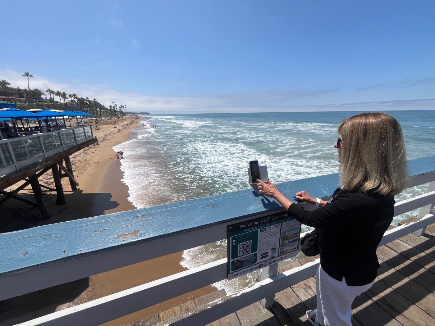
Taking a leisurely stroll along the iconic wooden pier in San Clemente? You might as well stop, snap a photo and become an instant citizen scientist.
A new CoastSnap project has launched to document the shoreline, allowing citizens to take a photo from their phones, upload it and add it to a collection of other time-stamped images in order to better understand coastal trends.
The project was set in motion by Save Our Beaches, an advocacy group launched a few years ago to give citizens a voice and seek solutions for the coastal town’s shrinking beaches, an issue that impacts everything from recreation to tourism and San Clemente’s economy.
The latest CoastSnap project is a collaboration with UC Santa Barbara and part of a larger study on how the shoreline changes throughout time, Save Our Beaches co-founder Suzie Whitelaw told a crowd that gathered on Friday, July 18 for a ribbon-cutting ceremony.
The city already does shoreline monitoring, but that is only done twice a year, and the contractors collect different types of data at various locations, including sand levels offshore.
“What this gets is a more frequent time scale, so we can see hour by hour how the beaches are changing,” Whitelaw said.
The images can also be stitched together to make a time lapse, so people can visualize how the shore changes with various swells, tides and seasons.


Some people have scoffed at sand nourishment projects, Whitelaw said, with a misconception that sand washes away in the winter and always comes back with summer swells.
But every year, more is taken away than returns, and beach nourishment helps create and maintain wider beaches for people to enjoy, she said.
Whitelaw talked about a big replenishment with 250,000 cubic yards of sand earlier this year around the pier, where sand with a darker brown hue was brought from the Surfside area off Huntington Beach. Because of the color difference, it is easy to see that waves have moved the sand all the way to the south end of town.
“I like data, and this brown sand provided the data,” she said.
A lighter color sand, brought from the Santa Ana River in Newport Beach, has migrated all the way to Linda Lane beach, she noted.
Whitelaw had heard about the CoastSnap project, originally created and launched in Australia, and then learned about a group in Oceanside testing it out.
Orange County Parks launched one at Strands Beach a year ago, and OC Parks has collected one to five snaps a day from the public to monitor coastal erosion in real time, incorporating tidal variations and weather conditions.
The installation of the CoastSnap station marked the completion of the Niguel Shores Revetment Restoration Project, required as part of a permit issued by the California Coastal Commission that made OC Parks responsible for complying with a plan for shore monitoring.
The CoastSnap project was initially only for San Diego’s shore, Whitelaw was informed. She joked that she could see San Diego’s coastline in the distance from the San Clemente Pier.
Researchers had one extra cradle — where people insert their phones so photos are always taken in the same spot — and agreed to allow San Clemente to use it.
CoastSnap is one of many research programs done by UC Santa Barbara’s Marine Science Institute on open ocean, coastal, and other aquatic ecosystems, said UC Santa Barbara assistant researcher Kyle A. Emery.
The work is being done through a research grant funded by California’s Ocean Protection Council. Emery and his team are using ground-based, drone and satellite data to monitor and evaluate beaches and dunes across California, including impacts from sea level rise and erosion, as well as restoration efforts.
The goal is to implement as many of the sites as possible statewide, with five new sites added through the recent project, including San Clemente Pier, Emery said in an email.
A California CoastSnap website and social media accounts are also in the works to help promote the tool and demonstrate the types of imagery and data that can be collected through this program, he noted.
The tool is easy to use, enabling anyone with a smartphone to take a photo from a fixed location and upload it to the CoastSnap app.
From there, the imagery can be utilized by researchers, managers, communities and the public to visualize change over time. It is also possible to extract the shoreline position from each image and track beach width over time, he said.
“We have received great feedback from sites with CoastSnap stations as well as community members who have used the tool. Many people contribute multiple photos a week,” Emery said. “We think this is a great tool for community engagement and for raising awareness about coastal change.”
Councilmember Rick Loeffler said there’s a science to keeping the beaches sandy, and he hopes people will understand the importance of sand nourishment in the future.
The city has upped its efforts in recent years, hauling and dredging in sand, and working with OCTA to figure out ways to bring more sand, in addition to rock boulders, to keep waves from washing away the beach.
“It’s going to mean we’re a beach town, instead of a rock town,” he said.
The city is also going to start an offshore investigation to find a closer sand source to pull from, rather than hauling in from areas far from its coastline.
The San Clemente Woman’s Club helped donate $1,000 for the signage that explains how the system works.
“One of our areas of interest is the environment, and protecting our environment,” Susan Ritschel, president of the Woman’s Club, said. “And for San Clemente, this is top of the list. We do everything we can to help it. I hope everyone learns how to use it and takes a photo every time we come down to the beach and pier so we have great monitoring information to help with our beaches.”